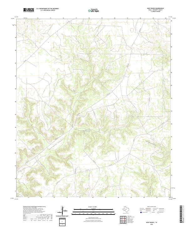
2022 Map of Hunt Ranch
USGS Topo · Published 2022About this map
Government Canyon and Bert Mertz Canyon dominate this part of Crockett County, where the high Edwards Plateau is deeply dissected by drainage systems leading toward the Pecos River valley. The landscape is defined by its network of ranch roads and specialized routes, such as Pandale Rd and FM 2083. The modern nomenclature of the area reflects both its physical geography and its historical associations with western travel and land use, seen in the naming of Wagon Trl Lp and Santa Fe Trl.
Find a feature on this map
15 named features on this map. Tap any name to fly to it.
Don’t see what you’re looking for? This feature index may not catch every label — zoom into the map to look around manually.
Map Details
Editions of this 2022 Hunt Ranch Map
This is the sole edition of this map. No revisions or reprints were ever made.
Other maps of this area

1954 · Sonora
USGS Topo · 1:250,000

1958 · Sonora
USGS Topo · 1:250,000

1967 · Ozona
USGS Topo · 1:24,000

1967 · Baggett Ranch
USGS Topo · 1:24,000

1967 · Pikes Peak
USGS Topo · 1:24,000

1967 · Hunt Ranch
USGS Topo · 1:24,000
1967 · Mitchell Canyon NE
USGS Topo · 1:24,000

1967 · Mitchell Canyon
USGS Topo · 1:24,000

1970 · Howards Well NE
USGS Topo · 1:24,000

1970 · Howards Well
USGS Topo · 1:24,000