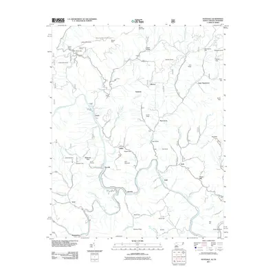
2011 Map of Huntdale
USGS Topo · Published 2011About this map
The Nolichucky River and North Toe River carve through the high elevations of the Unaka Mountains in this early 21st-century study of the North Carolina-Tennessee borderlands. The landscape is defined by its dramatic relief, spanning from the heights of Valhalla Dome and Rich Mountain down to river-level settlements. Genealogists will find family-named landmarks like Worrick Cemetery near Whiteoak Flats, while recreational features such as the Poplar Boat Ramp and Indian Grave Trailhead indicate the area's modern role as a center for outdoor activity. Smaller communities like Huntdale, Relief, and Tipton Hill are shown clustered near the water, following the natural corridors through the gaps and ridges. This map documents a region where traditional mountain settlements and public land conservation, represented by the Poplar Hunt Camp and Beauty Spot Observation Spot, coexist within the difficult terrain.
Find a feature on this map
77 named features on this map. Tap any name to fly to it.
Don’t see what you’re looking for? This feature index may not catch every label — zoom into the map to look around manually.
Map Details
Editions of this 2011 Huntdale Map
This is the sole edition of this map. No revisions or reprints were ever made.
Other maps of this area

1891 · Roan Mountain
USGS Topo · 1:125,000

1894 · Roan Mountain
USGS Topo · 1:125,000

1900 · Mount Mitchell
USGS Topo · 1:125,000

1902 · Mount Mitchell
USGS Topo · 1:125,000

1904 · Roan Mountain
USGS Topo · 1:125,000

1934 · Micaville
USGS Topo · 1:24,000

1934 · Bakersville
USGS Topo · 1:24,000

1934 · Iron Mtn Gap
USGS Topo · 1:24,000

1935 · Chestoa
USGS Topo · 1:24,000

1935 · Burnsville
USGS Topo · 1:24,000