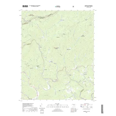
2019 Map of Huntdale
USGS Topo · Published 2019About this map
The North Toe River and Cane River converge to form the Nolichucky River at the southern boundary of the Cherokee National Forest, creating a complex aquatic junction near the Mitchell and Yancey County line. This mountain landscape is defined by its high-elevation gaps and scattered rural settlements such as Huntdale, Relief, and Tipton Hill. Small family-named landmarks like Worrick Cem and the Whiteoak Flats community are connected by winding mountain roads that follow the drainage patterns of Pigeonroost Cr and Brummett Cr.
Find a feature on this map
88 named features on this map. Tap any name to fly to it.
Don’t see what you’re looking for? This feature index may not catch every label — zoom into the map to look around manually.
Map Details
Editions of this 2019 Huntdale Map
This is the sole edition of this map. No revisions or reprints were ever made.
Other maps of this area

1891 · Roan Mountain
USGS Topo · 1:125,000

1894 · Roan Mountain
USGS Topo · 1:125,000

1900 · Mount Mitchell
USGS Topo · 1:125,000

1902 · Mount Mitchell
USGS Topo · 1:125,000

1904 · Roan Mountain
USGS Topo · 1:125,000

1934 · Micaville
USGS Topo · 1:24,000

1934 · Bakersville
USGS Topo · 1:24,000

1934 · Iron Mtn Gap
USGS Topo · 1:24,000

1935 · Chestoa
USGS Topo · 1:24,000

1935 · Burnsville
USGS Topo · 1:24,000