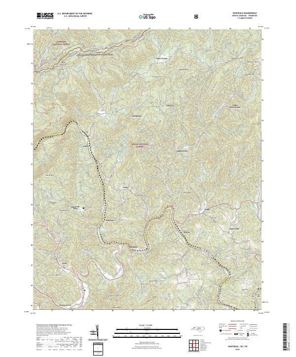
2022 Map of Huntdale
USGS Topo · Published 2022About this map
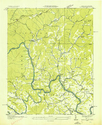
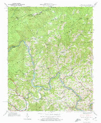
The Unaka Mountains dominate this region along the border of North Carolina and Tennessee, where the Appalachian National Scenic Trail winds through the Cherokee National Forest. This landscape is defined by the complex confluence of major waterways, including the Nolichucky River, North Toe River, and Cane River, which carve deep valleys between high ridges like Peterson Ridge and Laurel Ridge. The settlement pattern follows these watercourses, with small communities such as Huntdale, Poplar, and Relief situated near the riverbanks. Family history and local heritage are marked by sites like the Worrick Cem near Whiteoak Flats, while the presence of the Unimin Plant Rd near Red Hill suggests the industrial activities tied to the area's mineral resources. This map captures the intersection of high-elevation wilderness in the Pisgah National Forest and the enduring river-valley hamlets of the southern Appalachians.
Find a feature on this map
107 named features on this map. Tap any name to fly to it.
Don’t see what you’re looking for? This feature index may not catch every label — zoom into the map to look around manually.
Map Details
Editions of this 2022 Huntdale Map
This is the sole edition of this map. No revisions or reprints were ever made.
Historical Maps of Ramseytown Through Time
3 maps found