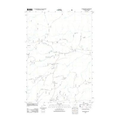
2012 Map of Hunter Mesa
USGS Topo · Published 2012About this map
Hunter Mesa and the surrounding high-country plateaus define this corner of Johnson County, where a network of forest roads connects seasonal camps and livestock outposts. The landscape is deeply incised by the drainage of French Cr, N Clear Cr, and Sourdough Cr, creating a series of named parks and meadows that have long served as landmarks for ranchers and travelers. Distinctive local sites like Paradise Ranch and Hunter Corral reflect the area’s enduring ties to mountain ranching, while French Creek Cow Camp and Cross H Cow Camp suggest a geography shaped by the movement of cattle. Recreation and education are woven into the terrain at Schoolhouse Park and the County Youth Camp. This survey documents a quiet interior of Wyoming where water sources such as Hospital Hill Springs and Fox Cabin Spring remain vital points of interest.
Find a feature on this map
54 named features on this map. Tap any name to fly to it.
Don’t see what you’re looking for? This feature index may not catch every label — zoom into the map to look around manually.
Map Details
Editions of this 2012 Hunter Mesa Map
This is the sole edition of this map. No revisions or reprints were ever made.
Other maps of this area

1899 · Cloud peak
USGS Topo · 1:125,000

1900 · Fort McKinney
USGS Topo · 1:125,000

1901 · Cloud Peak
USGS Topo · 1:125,000

1903 · Fort McKinney
USGS Topo · 1:125,000

1955 · Sheridan
USGS Topo · 1:250,000

1958 · Sheridan
USGS Topo · 1:250,000

1962 · Sheridan
USGS Topo · 1:250,000

1967 · Lake De Smet West
USGS Topo · 1:24,000
1967 · Willow Park Reservoir
USGS Topo · 1:24,000

1967 · Caribou Creek
USGS Topo · 1:24,000