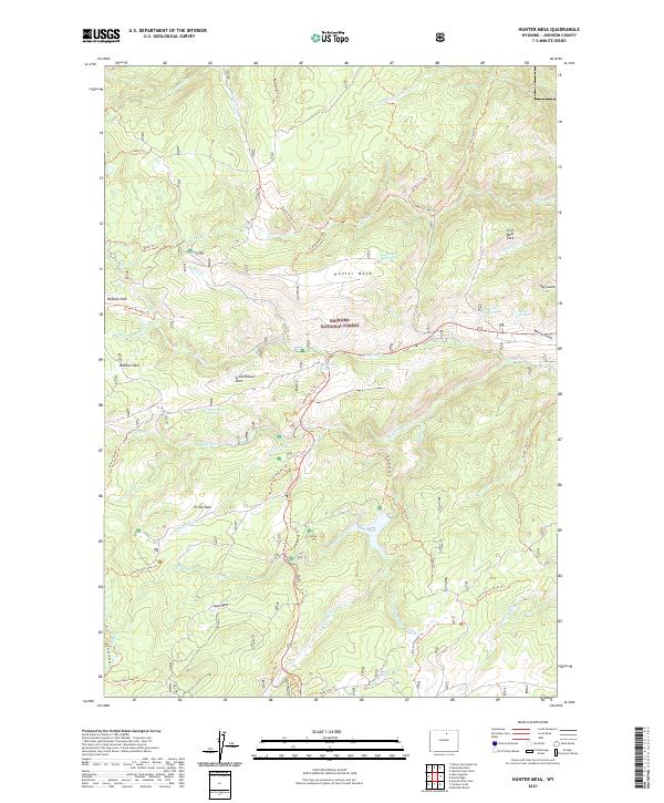
2021 Map of Hunter Mesa
USGS Topo · Published 2021About this map
Bighorn National Forest encompasses the high country of Johnson County, featuring a complex network of alpine meadows and water sources typical of the eastern Bighorn Mountains. The landscape is defined by extensive plateau regions like Hunter Mesa and Schoolhouse Park, separated by deep drainage systems. Water is a defining feature here, with numerous perennial sources including East Hunter Mesa Spring, Hospital Hill Springs, and Mosier Springs feeding the primary waterways of French Creek and North Clear Creek. The presence of Fox Cabin Spring and the numerous trail systems, such as the French Creek Trail and Tie Hack Trail, suggests a long history of seasonal grazing and forest management. These trails often follow the natural contours of the mountain parks, providing access between the higher elevations and the lower creek valleys.
Find a feature on this map
57 named features on this map. Tap any name to fly to it.
Don’t see what you’re looking for? This feature index may not catch every label — zoom into the map to look around manually.
Map Details
Editions of this 2021 Hunter Mesa Map
This is the sole edition of this map. No revisions or reprints were ever made.
Other maps of this area

1899 · Cloud peak
USGS Topo · 1:125,000

1900 · Fort McKinney
USGS Topo · 1:125,000

1901 · Cloud Peak
USGS Topo · 1:125,000

1903 · Fort McKinney
USGS Topo · 1:125,000

1955 · Sheridan
USGS Topo · 1:250,000

1958 · Sheridan
USGS Topo · 1:250,000

1962 · Sheridan
USGS Topo · 1:250,000

1967 · Lake De Smet West
USGS Topo · 1:24,000
1967 · Willow Park Reservoir
USGS Topo · 1:24,000

1967 · Caribou Creek
USGS Topo · 1:24,000