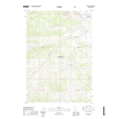
2021 Map of Hunter Peak
USGS Topo · Published 2021About this map
The Shoshone National Forest dominates this high-elevation landscape, where the Absaroka Range provides a backdrop for a complex network of backcountry trails and glacial drainages. In the northeast corner, the Clarks Fork Wild and Scenic River carves through the terrain near Old Cooke City Rd, a traditional transit corridor through these mountains. The area is defined by its extensive trail systems, such as the North Crandal Trl and Papoose Ridge Trl, which follow the contours of the land rather than modern road patterns. Numerous named water bodies like Crandall Cr, Hoodoo Cr, and Wolverine Cr drain the steep slopes surrounding Hunter Peak, illustrating the primary role of high-country watersheds in shaping the regional geography.
Find a feature on this map
34 named features on this map. Tap any name to fly to it.
Don’t see what you’re looking for? This feature index may not catch every label — zoom into the map to look around manually.
Map Details
Editions of this 2021 Hunter Peak Map
This is the sole edition of this map. No revisions or reprints were ever made.
Other maps of this area

1896 · Crandall Creek
USGS Topo · 1:125,000

1899 · Crandall
USGS Topo · 1:125,000

1955 · Cody
USGS Topo · 1:250,000

1956 · Sunlight Peak
USGS Topo · 1:62,500

1956 · Beartooth Butte
USGS Topo · 1:62,500

1956 · Pilot Peak
USGS Topo · 1:62,500

1956 · Dead Indian Peak
USGS Topo · 1:62,500

1958 · Cody
USGS Topo · 1:250,000

1962 · Cody
USGS Topo · 1:250,000

1980 · Cody
USGS Topo · 1:100,000