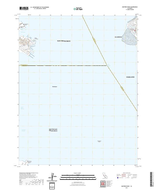
2021 Map of Hunters Point
USGS Topo · Published 2021About this map
The San Francisco Peninsula shoreline dominates this 2021 study of the maritime and industrial interface between San Francisco, Brisbane, and South San Francisco. Maritime infrastructure is well-defined at Hunters Point and Point Avisadero, where industrial inlets like Lash Lighter Basin and India Basin meet the open waters of San Francisco Bay. This chart highlights the modern configuration of the bay's deep-water navigation routes, including the Oyster Point Channel and the San Bruno Channel leading toward the San Francisco International Airport at the southern edge of the sheet. Across the bay, the residential and parkland layout of Bay Farm Island in Alameda is visible, providing a clear view of the jurisdictional boundaries where San Francisco and San Mateo counties meet. The absence of heavy contours emphasizes the low-lying, engineered nature of this urban coastal environment, specifically around the San Bruno Shoal.
Find a feature on this map
33 named features on this map. Tap any name to fly to it.
Don’t see what you’re looking for? This feature index may not catch every label — zoom into the map to look around manually.
Map Details
Editions of this 2021 Hunters Point Map
This is the sole edition of this map. No revisions or reprints were ever made.
Other maps of this area

1892 · San Mateo
USGS Topo · 1:62,500

1895 · San Francisco
USGS Topo · 1:62,500

1896 · San Mateo
USGS Topo · 1:62,500

1897 · Concord
USGS Topo · 1:62,500

1899 · San Francisco
USGS Topo · 1:62,500

1899 · Haywards
USGS Topo · 1:62,500

1899 · San Mateo
USGS Topo · 1:62,500

1915 · San Mateo
USGS Topo · 1:62,500

1915 · Haywards
USGS Topo · 1:62,500

1915 · Concord
USGS Topo · 1:62,500