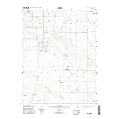
2017 Map of Huntington
USGS Topo · Published 2017About this map
The town of Huntington serves as the focal point of this Eastern Utah landscape, where a precise grid of streets meets an extensive network of irrigation infrastructure. The agricultural character of the region is defined by the Cleveland Canal, the Mammoth Canal, and the Cleveland Center Ditch, which redirect water across the arid flats to support local farming. To the north of the settlement, Huntington Lake and the Huntington Municipal Airport stand near Nosey Joe Flat, while the smaller community of Lawrence lies to the south.
Find a feature on this map
80 named features on this map. Tap any name to fly to it.
Don’t see what you’re looking for? This feature index may not catch every label — zoom into the map to look around manually.
Map Details
Editions of this 2017 Huntington Map
This is the sole edition of this map. No revisions or reprints were ever made.
Other maps of this area

1885 · Manti
USGS Topo · 1:250,000

1886 · Price River
USGS Topo · 1:250,000

1895 · Manti
USGS Topo · 1:250,000

1896 · Price River
USGS Topo · 1:250,000

1923 · Castle Dale
USGS Topo · 1:62,500

1923 · Hiawatha
USGS Topo · 1:62,500

1925 · Castle Dale
USGS Topo · 1:62,500

1925 · Hiawatha
USGS Topo · 1:62,500

1956 · Price
USGS Topo · 1:250,000

1960 · Price
USGS Topo · 1:250,000