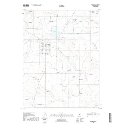
2020 Map of Huntington
USGS Topo · Published 2020About this map
Huntington serves as the primary hub in this central Utah landscape, defined by a grid of residential streets and its proximity to the waters of Huntington Cr. The surrounding desert terrain is heavily modified by an intricate network of irrigation features, including the Cleveland Canal, the N Br Cleveland Canal, and the Mammoth Canal, which support agriculture across the flats. To the southeast, the smaller settlement of Lawrence sits near the McElprang Wash, while the expansive Huntington Lake State Park provides a major recreational anchor to the north. Genealogists will find three distinct burial sites on this sheet: the Huntington City Cem, the Lawrence Cem, and the small Tucker Family Cem located near the Cleveland Center Ditch. The geography is characterized by dramatic elevation changes at Buffalo Bench, Allens Hill, and the Blue Slate Hills.
Find a feature on this map
66 named features on this map. Tap any name to fly to it.
Don’t see what you’re looking for? This feature index may not catch every label — zoom into the map to look around manually.
Map Details
Editions of this 2020 Huntington Map
This is the sole edition of this map. No revisions or reprints were ever made.
Other maps of this area

1885 · Manti
USGS Topo · 1:250,000

1886 · Price River
USGS Topo · 1:250,000

1895 · Manti
USGS Topo · 1:250,000

1896 · Price River
USGS Topo · 1:250,000

1923 · Castle Dale
USGS Topo · 1:62,500

1923 · Hiawatha
USGS Topo · 1:62,500

1925 · Castle Dale
USGS Topo · 1:62,500

1925 · Hiawatha
USGS Topo · 1:62,500

1956 · Price
USGS Topo · 1:250,000

1960 · Price
USGS Topo · 1:250,000