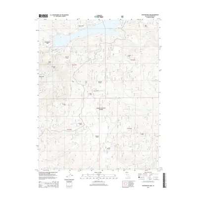
2015 Map of Huntington Lake
USGS Topo · Published 2015About this map
Huntington Lake sits at the heart of this high-elevation landscape within the Sierra National Forest, serving as a central hub for the small community at Cedar Crest. The terrain is defined by dramatic granite features and high ridges, including Kerckhoff Dome, Tamarack Mtn, and Chinese Peak. To the southwest, the settlement of Big Creek marks a significant drop in elevation as the namesake waterway carves through Big Creek Canyon. This geography reflects the 20th-century development of hydroelectric power and mountain recreation in Fresno County, where numerous small creeks like Home Camp Cr and Snowslide Cr feed the larger basins. Subtle meadows such as Boneyard Meadow and Cutts Meadow provide natural breaks in the timbered slopes, while smaller alpine bodies like Mirror Lake and West Lake are found at higher reaches.
Find a feature on this map
42 named features on this map. Tap any name to fly to it.
Don’t see what you’re looking for? This feature index may not catch every label — zoom into the map to look around manually.
Map Details
Editions of this 2015 Huntington Lake Map
This is the sole edition of this map. No revisions or reprints were ever made.
Other maps of this area

1904 · Kaiser
USGS Topo · 1:125,000

1947 · Mariposa
USGS Topo · 1:250,000

1948 · Mariposa
USGS Topo · 1:250,000

1953 · Huntington Lake
USGS Topo · 1:62,500

1953 · Shaver Lake
USGS Topo · 1:62,500

1953 · Shuteye Peak
USGS Topo · 1:62,500

1953 · Kaiser Peak
USGS Topo · 1:62,500

1957 · Mariposa
USGS Topo · 1:250,000

1963 · Mariposa
USGS Topo · 1:250,000

1980 · Shaver Lake
USGS Topo · 1:100,000