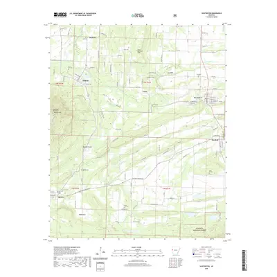
2020 Map of Huntington
USGS Topo · Published 2020About this map
Huntington and Mansfield anchor this 2020 record of the Arkansas-Oklahoma borderlands, where the landscape is defined by the sharp ridges of the Sugar Loaf Mountains and Devils Backbone Ridge. The map documents a dense network of rural settlements like Frog Town, Arkola, and Montreal, often clustered near established family cemeteries and local landmarks. To the south, the terrain rises into the Ouachita National Forest, while the northern reaches follow the winding courses of James Fork and Prairie Cr. The concentration of burial sites, including Buggy Hill Cem and the Hartford Memorial Cem, provides significant value for genealogists tracing family lineages in this corner of Sebastian County. These features, combined with named elevations like Midland Peak and Number 5 Hill, reveal the enduring geographic character of a region shaped by both its mountain topography and small-town roots.
Find a feature on this map
99 named features on this map. Tap any name to fly to it.
Don’t see what you’re looking for? This feature index may not catch every label — zoom into the map to look around manually.
Map Details
Editions of this 2020 Huntington Map
This is the sole edition of this map. No revisions or reprints were ever made.
Other maps of this area

1879 · Poteau Mountain
USGS Topo · 1:62,500

1887 · Poteau Mountain #1
USGS Topo · 1:62,500

1887 · Poteau Mountain #2
USGS Topo · 1:62,500

1887 · Greenwood
USGS Topo · 1:62,500

1890 · Fort Smith
USGS Topo · 1:125,000

1890 · Poteau Mountain
USGS Topo · 1:125,000

1899 · Poteau Mountain
USGS Topo · 1:125,000

1906 · Barber
USGS Topo · 1:62,500

1939 · Waldron
USGS Topo · 1:62,500

1940 · Waldron
USGS Topo · 1:62,500