2021 Map of Huntley
USGS Topo · Published 2021About this map
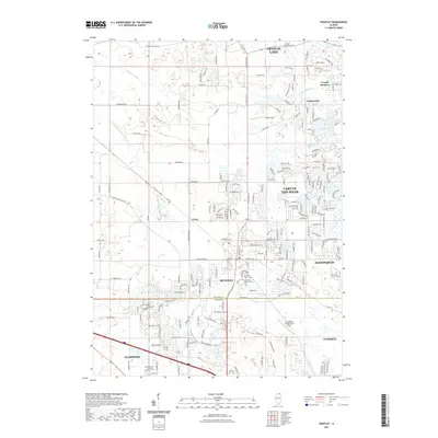
Huntley serves as a central hub in this modern survey, marking the transition between the dense residential developments of Lake In The Hills and the agricultural landscapes along the Kishwaukee River. The mapping shows a significant cluster of genealogical sites near the town center, including Huntley Cem - West, Huntley Cem - East, and the Saint Mary Catholic Cem. To the north, the terrain softens into the Turnberry Wetlands and the outskirts of Crystal Lake, where the South Lake drainage area meets established neighborhoods like Lakewood and Crystal Gardens. The map also captures specialized land use in the southern portion of the quadrangle, notably the Landings Condominium Airport and the distinct boundary separating McHenry Co and Kane Co, illustrating how municipal expansion and infrastructure have reshaped this corner of Illinois.
Find a feature on this map
201 named features on this map. Tap any name to fly to it.
Don’t see what you’re looking for? This feature index may not catch every label — zoom into the map to look around manually.
Map Details
Editions of this 2021 Huntley Map
This is the sole edition of this map. No revisions or reprints were ever made.
Other maps of this area

1925 · Elgin
USGS Topo · 1:62,500

1926 · Mc Henry
USGS Topo · 1:62,500

1932 · Harvard
USGS Topo · 1:48,000

1937 · Harvard
USGS Topo · 1:62,500

1938 · Genoa
USGS Topo · 1:62,500

1940 · Elgin
USGS Topo · 1:62,500

1944 · McHenry
USGS Topo · 1:62,500

1954 · Rockford
USGS Topo · 1:250,000

1955 · Rockford
USGS Topo · 1:250,000

1958 · Rockford
USGS Topo · 1:250,000