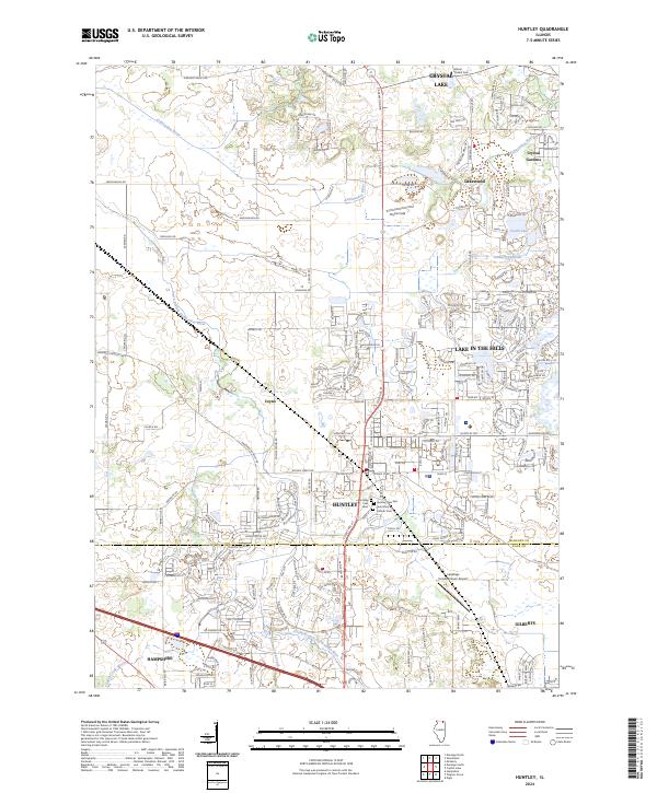
2024 Map of Huntley
USGS Topo · Published 2024About this map
The Kishwaukee River and its south branch define the hydrologic character of this Illinois landscape, which straddles the McHenry Co and Kane Co line. Rapid residential expansion is evident through the dense subdivision networks of Lake In The Hills and Huntley, contrasted by the more open tracts of Phyllis Field and the Turnberry Wetlands. Genealogists and local historians will find significant detail in the mapping of local burial grounds, including Mount Thabor Cem, Huntley Cem East, and Saint Mary Catholic Cem. The map documents a contemporary transportation and utility corridor, featuring the Landings Condominium-Airport and a complex grid of rural and suburban routes like Marengo Huntley Rd and Dietrich Rd connecting outlying settlements like Coyne and Hampshire.
Find a feature on this map
39 named features on this map. Tap any name to fly to it.
Don’t see what you’re looking for? This feature index may not catch every label — zoom into the map to look around manually.
Map Details
Editions of this 2024 Huntley Map
This is the sole edition of this map. No revisions or reprints were ever made.
Other maps of this area

1925 · Elgin
USGS Topo · 1:62,500

1926 · Mc Henry
USGS Topo · 1:62,500

1932 · Harvard
USGS Topo · 1:48,000

1937 · Harvard
USGS Topo · 1:62,500

1938 · Genoa
USGS Topo · 1:62,500

1940 · Elgin
USGS Topo · 1:62,500

1944 · McHenry
USGS Topo · 1:62,500

1954 · Rockford
USGS Topo · 1:250,000

1955 · Rockford
USGS Topo · 1:250,000

1958 · Rockford
USGS Topo · 1:250,000