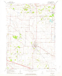
1962 Map of Huntley
USGS Topo · Published 1964About this map
Huntley serves as the primary hub of activity in this northern Illinois landscape, positioned at the intersection of the Chicago and North Western railroad and several regional routes. The map illustrates a transitional period where agricultural township lines of Seneca, Dorr, Coral, and Grafton meet the burgeoning modern infrastructure of the Northwest Tollway. To the north, the Kishwaukee River and its South Branch wind through the terrain, passing near the small settlement of Coyne and the Pleasant Valley Camp. Cultural landmarks such as Grange Hall, Mt Thabor Cem, and St Marys Cem provide specific points of interest for genealogists tracing local families. The presence of the Bit-O-Heather Golf Club and Crystal Gardens near the northern boundary indicates the mid-century shift toward recreational land use alongside the area's established gravel mining operations.
Find a feature on this map
46 named features on this map. Tap any name to fly to it.
Don’t see what you’re looking for? This feature index may not catch every label — zoom into the map to look around manually.
Map Details
Editions of this 1962 Huntley Map
This is the sole edition of this map. No revisions or reprints were ever made.
Other maps of this area

1925 · Elgin
USGS Topo · 1:62,500

1926 · Mc Henry
USGS Topo · 1:62,500

1932 · Harvard
USGS Topo · 1:48,000

1937 · Harvard
USGS Topo · 1:62,500

1938 · Genoa
USGS Topo · 1:62,500

1940 · Elgin
USGS Topo · 1:62,500

1944 · McHenry
USGS Topo · 1:62,500

1954 · Rockford
USGS Topo · 1:250,000

1955 · Rockford
USGS Topo · 1:250,000

1958 · Rockford
USGS Topo · 1:250,000