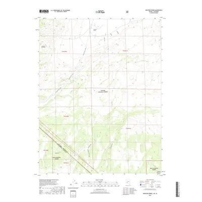
2018 Map of Huntoon Spring
USGS Topo · Published 2018About this map
Huntoon Valley serves as a high-altitude drainage corridor between the Excelsior Mountains and the Huntoon Mountains along the border of Nevada and California. The landscape is defined by the ephemeral flow of Huntoon Cr, which leads toward the vital Huntoon Spring, a critical water source in this arid high-desert environment. Much of the terrain is protected within the Toiyabe National Forest and the Inyo National Forest, preserving the original character of the land as it was during the early prospecting eras.
Find a feature on this map
18 named features on this map. Tap any name to fly to it.
Don’t see what you’re looking for? This feature index may not catch every label — zoom into the map to look around manually.
Map Details
Editions of this 2018 Huntoon Spring Map
This is the sole edition of this map. No revisions or reprints were ever made.
Other maps of this area

1909 · Hawthorne
USGS Topo · 1:250,000

1911 · Hawthorne
USGS Topo · 1:250,000

1914 · Mt. Morrison
USGS Topo · 1:125,000

1915 · Hawthorne
USGS Topo · 1:250,000

1917 · White Mountain
USGS Topo · 1:125,000

1947 · Mariposa
USGS Topo · 1:250,000

1948 · Walker Lake
USGS Topo · 1:250,000

1948 · Mariposa
USGS Topo · 1:250,000

1957 · Walker Lake
USGS Topo · 1:250,000

1957 · Mariposa
USGS Topo · 1:250,000