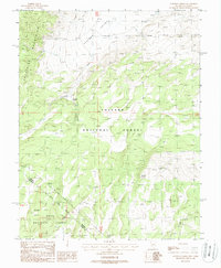
1988 Map of Huntoon Spring
USGS Topo · Published 1988About this map
Huntoon Spring serves as a critical water source in the high-elevation basin where the Excelsior Mountains and Adobe Hills converge along the Nevada-California state line. This 1980s landscape is characterized by its high-desert isolation, split between the Toiyabe National Forest and Inyo National Forest. Evidence of prospecting and extraction is found at Ant Projects and a specific Mine Shaft located northwest of the Huntoon Valley. The map details a network of 4wd tracks and seasonal waterways like Huntoon Creek that define the local topography. Boundary markers such as Mon 51 and Mon 52 denote the precise surveying of the state border, providing essential reference points for those studying the administrative and physical geography of this remote Great Basin region.
Find a feature on this map
21 named features on this map. Tap any name to fly to it.
Don’t see what you’re looking for? This feature index may not catch every label — zoom into the map to look around manually.
Map Details
Editions of this 1988 Huntoon Spring Map
This is the sole edition of this map. No revisions or reprints were ever made.
Other maps of this area

1909 · Hawthorne
USGS Topo · 1:250,000

1911 · Hawthorne
USGS Topo · 1:250,000

1914 · Mt. Morrison
USGS Topo · 1:125,000

1915 · Hawthorne
USGS Topo · 1:250,000

1917 · White Mountain
USGS Topo · 1:125,000

1947 · Mariposa
USGS Topo · 1:250,000

1948 · Walker Lake
USGS Topo · 1:250,000

1948 · Mariposa
USGS Topo · 1:250,000

1957 · Walker Lake
USGS Topo · 1:250,000

1957 · Mariposa
USGS Topo · 1:250,000