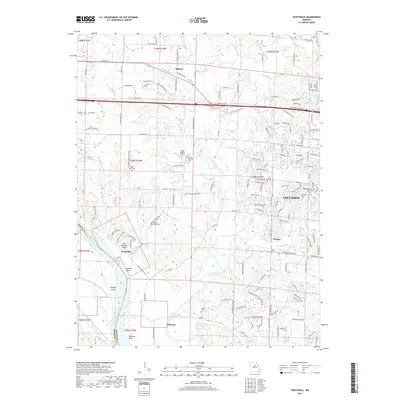
2017 Map of Huntsdale
USGS Topo · Published 2017About this map
The Missouri River carves a sweeping arc through the southwest corner of this Boone County landscape, defined by dramatic features like Big Manitou Bluffs and Tadpole Island near Searcys Bend. The floodplain gives way to the small settlements of Huntsdale and McBaine, where the river’s historical influence on local transport and topography is most evident. Further north, the terrain transitions into the upland plains hosting the western edge of Columbia and the community of Midway, reflecting the modern expansion of the region.
Find a feature on this map
177 named features on this map. Tap any name to fly to it.
Don’t see what you’re looking for? This feature index may not catch every label — zoom into the map to look around manually.
Map Details
Editions of this 2017 Huntsdale Map
This is the sole edition of this map. No revisions or reprints were ever made.
Other maps of this area

1886 · Jefferson City
USGS Topo · 1:125,000

1888 · Boonville
USGS Topo · 1:125,000

1890 · Moberly
USGS Topo · 1:125,000

1890 · Glasgow
USGS Topo · 1:125,000

1894 · Jefferson City
USGS Topo · 1:125,000

1917 · Sturgeon
USGS Topo · 1:62,500

1935 · Columbia
USGS Topo · 1:24,000

1940 · Columbia
USGS Topo · 1:24,000

1947 · Jefferson City
USGS Topo · 1:250,000
1948 · Columbia
USGS Topo · 1:24,000