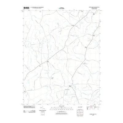
2010 Map of Hurdle Mills
USGS Topo · Published 2010About this map
The South Flat River and North Flat River converge in this rural North Carolina landscape, defining the hydrology of the Piedmont region south of Roxboro. Small crossroads communities and family-named locales such as Hurdle Mills, Bushy Fork, and Whitt Town anchor the local geography, connected by a network of winding roads like Yarborough Rd and Dan Winstead Rd. The map illustrates a transition toward modern utility with landmarks like the Whitfield Farms Airport and several engineered water features, including the Whitfield Pond Dam and Thaxton Pond Dam.
Find a feature on this map
73 named features on this map. Tap any name to fly to it.
Don’t see what you’re looking for? This feature index may not catch every label — zoom into the map to look around manually.
Map Details
Editions of this 2010 Hurdle Mills Map
This is the sole edition of this map. No revisions or reprints were ever made.
Other maps of this area

1943 · Roxboro
USGS Topo · 1:62,500

1951 · Durham North
USGS Topo · 1:62,500

1953 · Greensboro
USGS Topo · 1:250,000

1954 · Greensboro
USGS Topo · 1:250,000

1962 · Greensboro
USGS Topo · 1:250,000

1966 · Greensboro
USGS Topo · 1:250,000

1967 · Cedar Grove
USGS Topo · 1:24,000

1968 · Leasburg
USGS Topo · 1:24,000

1968 · Caldwell
USGS Topo · 1:24,000

1968 · Ridgeville
USGS Topo · 1:24,000