
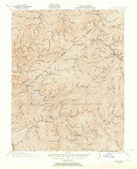
1915 Map of Hurley
USGS Topo · Published 1915About this map
Grundy and the surrounding hollows of Buchanan Co are captured here during a period of early 20th-century development just before World War I. This advance sheet, surveyed in cooperation with the State of Virginia Geological Survey and the State of Kentucky Geological Survey, details a landscape where life was organized around the intricate drainage systems of Knox Creek and Slate Creek. The map provides an exceptionally high density of rural educational markers for the era, identifying remote centers of learning such as Upper Rocklick School, Looneyville School, and Slate School. Settlement patterns follow the narrow valley floors, with community hubs established at Hurley and the Pawpaw P O. The presence of numerous named branches and forks, including Knotty Poplar Fork and Lester Fork, underscores the importance of local topography in defining property and community boundaries in this corner of the Commonwealth.
Find a feature on this map
52 named features on this map. Tap any name to fly to it.
Don’t see what you’re looking for? This feature index may not catch every label — zoom into the map to look around manually.
Map Details
Editions of this 1915 Hurley Map
2 editions found
Other maps of this area

1886 · Grundy
USGS Topo · 1:125,000

1887 · Warfield
USGS Topo · 1:125,000

1890 · Grundy
USGS Topo · 1:125,000

1891 · Tazewell
USGS Topo · 1:125,000

1891 · Oceana
USGS Topo · 1:125,000

1891 · Warfield
USGS Topo · 1:125,000

1892 · Grundy
USGS Topo · 1:125,000

1893 · Oceana
USGS Topo · 1:125,000

1895 · Tazewell
USGS Topo · 1:125,000

1897 · Tazewell
USGS Topo · 1:125,000