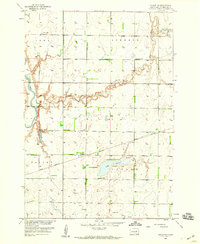
1958 Map of Huron NE
USGS Topo · Published 1959About this map
The James River and its meandering tributary Shue Creek define the prairie landscape of Beadle County in the late 1950s. This survey, published as part of the Department of the Interior's Missouri River Basin development program, details the agrarian infrastructure between the townships of Iowa, Liberty, and Cavour. The settlement of Cavour sits along the southern edge of Lake Cavour, serving as a focal point for the surrounding rural sections. Transportation is dominated by the Great Northern railroad, which cuts east-to-west through the small community of Sheffield.
Find a feature on this map
17 named features on this map. Tap any name to fly to it.
Don’t see what you’re looking for? This feature index may not catch every label — zoom into the map to look around manually.
Map Details
Editions of this 1958 Huron NE Map
This is the sole edition of this map. No revisions or reprints were ever made.
Other maps of this area

1895 · Byron
USGS Topo · 1:125,000

1898 · Huron
USGS Topo · 1:125,000

1899 · De Smet
USGS Topo · 1:125,000

1953 · Huron
USGS Topo · 1:250,000

1953 · Watertown
USGS Topo · 1:250,000

1954 · Huron
USGS Topo · 1:250,000

1956 · Lake Byron
USGS Topo · 1:24,000

1956 · Lake Byron SE
USGS Topo · 1:24,000

1957 · Cavour
USGS Topo · 1:24,000

1957 · Huron
USGS Topo · 1:24,000