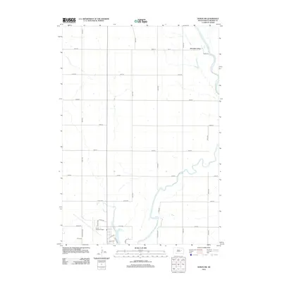
2012 Map of Huron NW
USGS Topo · Published 2012About this map
The James River winds through the eastern portion of this Beadle County landscape, creating a sinuous riparian corridor across the otherwise geometric grid of the Great Plains. To the north, the Riverside Colony stands as a distinct communal settlement pattern near the riverbanks, illustrating the region's unique cultural and agrarian history. The southern edge of the map transitions into the outskirts of Huron, where the organized infrastructure of the Huron Regional Airport and residential street networks like Ohio Ave Nw and Lincoln Ave Nw begin to concentrate. Water management and local recreation are centered around Ravine Park Lake, which anchors the urbanizing fringe. This survey documents the intersection of rural Hutterite colonial life, a meandering prairie river system, and the expanding transportation and residential footprint of a key South Dakota regional hub.
Find a feature on this map
31 named features on this map. Tap any name to fly to it.
Don’t see what you’re looking for? This feature index may not catch every label — zoom into the map to look around manually.
Map Details
Editions of this 2012 Huron NW Map
This is the sole edition of this map. No revisions or reprints were ever made.
Other maps of this area

1895 · Byron
USGS Topo · 1:125,000

1898 · Huron
USGS Topo · 1:125,000

1953 · Huron
USGS Topo · 1:250,000

1954 · Huron
USGS Topo · 1:250,000

1956 · Lake Byron
USGS Topo · 1:24,000

1956 · Lake Byron SE
USGS Topo · 1:24,000

1956 · Hitchcock SE
USGS Topo · 1:24,000

1957 · Cavour
USGS Topo · 1:24,000

1957 · Huron
USGS Topo · 1:24,000

1958 · Huron NW
USGS Topo · 1:24,000