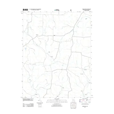
2011 Map of Hurricane
USGS Topo · Published 2011About this map
Crooked Creek and its many tributaries, including Huffmans Creek and Punch Creek, define the drainage patterns of this rural Missouri landscape. Scattered settlements like Tallent, Loyd, and Hurricane serve as local anchors connected by a network of county roads. The area is notable for its high density of family and community burial grounds, such as Old Concord Cemetery, Slinkard Cemetery, and Berry Cemetery, which offer significant value for genealogical research. The topography is marked by localized features like Diddle Hill and Gum Hollow, while larger water bodies like Shaw Lake provide rare open water. This 2011 survey illustrates a region where land use remains primarily agricultural or forested, following the natural contours of the creek beds and ridges that have shaped Bollinger County's rural identity for generations.
Find a feature on this map
53 named features on this map. Tap any name to fly to it.
Don’t see what you’re looking for? This feature index may not catch every label — zoom into the map to look around manually.
Map Details
Editions of this 2011 Hurricane Map
This is the sole edition of this map. No revisions or reprints were ever made.
Other maps of this area

1910 · Higdon
USGS Topo · 1:62,500

1923 · Perryville
USGS Topo · 1:62,500

1924 · Perryville
USGS Topo · 1:62,500

1933 · Marble Hill
USGS Topo · 1:62,500

1933 · Marquand
USGS Topo · 1:62,500

1937 · Marble Hill
USGS Topo · 1:62,500

1938 · Marquand
USGS Topo · 1:62,500

1949 · Paducah
USGS Topo · 1:250,000

1949 · Rolla
USGS Topo · 1:250,000

1950 · Paducah
USGS Topo · 1:250,000