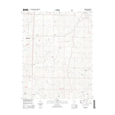
2015 Map of Hurricane
USGS Topo · Published 2015About this map
Patton and Hurricane anchor this rural landscape in Bollinger County, where the eastern foothills of the Saint Francois Mountains meet a dense network of creek valleys. The topography is defined by the winding paths of Hurricane Cr and Crooked Cr, which historically dictated the placement of small settlements and a high concentration of family burial grounds. Notable sites including the Slinkard Cemetery, Old Concord Cemetery, and Hawn Cemetery are distributed throughout these valleys, reflecting a long-standing pattern of localized community clusters such as Tallent and Loyd. A portion of the Mark Twain National Forest occupies the northwestern corner, providing a glimpse into the managed timberlands that characterize the region. The map preserves the names of numerous minor waterways like Indian Cr and Punch Cr, alongside distinctive terrain markers like Diddle Hill and Gum Hollow, which serve as critical landmarks for local history researchers.
Find a feature on this map
65 named features on this map. Tap any name to fly to it.
Don’t see what you’re looking for? This feature index may not catch every label — zoom into the map to look around manually.
Map Details
Editions of this 2015 Hurricane Map
This is the sole edition of this map. No revisions or reprints were ever made.
Other maps of this area

1910 · Higdon
USGS Topo · 1:62,500

1923 · Perryville
USGS Topo · 1:62,500

1924 · Perryville
USGS Topo · 1:62,500

1933 · Marble Hill
USGS Topo · 1:62,500

1933 · Marquand
USGS Topo · 1:62,500

1937 · Marble Hill
USGS Topo · 1:62,500

1938 · Marquand
USGS Topo · 1:62,500

1949 · Paducah
USGS Topo · 1:250,000

1949 · Rolla
USGS Topo · 1:250,000

1950 · Paducah
USGS Topo · 1:250,000