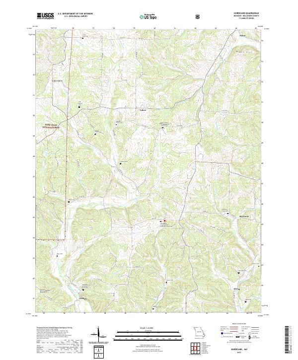
2021 Map of Hurricane
USGS Topo · Published 2021About this map
Bollinger County's rural interior is defined by a series of small, interconnected settlements and numerous family and community cemeteries along the Ozark foothills. Small population centers like Tallent, Hurricane, and Shrum serve as anchors for a landscape etched by winding waterways such as Crooked Cr and Hurricane Cr. The map reveals a high density of spiritual and memorial sites, including the Mount Carmel Missionary Baptist Church Cem and the New Bethel Congregational Methodist Church Cem, reflecting the deep-rooted social fabric of these Missouri communities. To the west, the boundaries of the Mark Twain National Forest begin to dominate the terrain as the elevation rises into the Saint Francois Mountains. This detailed survey captures the persistence of traditional land divisions and the road networks that link these remote hamlets, providing a comprehensive look at the region's cultural geography.
Find a feature on this map
77 named features on this map. Tap any name to fly to it.
Don’t see what you’re looking for? This feature index may not catch every label — zoom into the map to look around manually.
Map Details
Editions of this 2021 Hurricane Map
This is the sole edition of this map. No revisions or reprints were ever made.
Other maps of this area

1910 · Higdon
USGS Topo · 1:62,500

1923 · Perryville
USGS Topo · 1:62,500

1924 · Perryville
USGS Topo · 1:62,500

1933 · Marble Hill
USGS Topo · 1:62,500

1933 · Marquand
USGS Topo · 1:62,500

1937 · Marble Hill
USGS Topo · 1:62,500

1938 · Marquand
USGS Topo · 1:62,500

1949 · Paducah
USGS Topo · 1:250,000

1949 · Rolla
USGS Topo · 1:250,000

1950 · Paducah
USGS Topo · 1:250,000