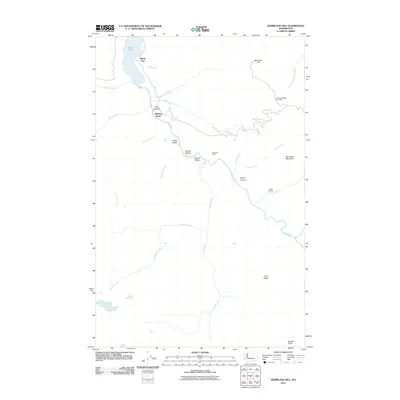
2011 Map of Hurricane Hill
USGS Topo · Published 2011About this map
Elwha River corridors and the steep mountain drainage of Hurricane Hill define this landscape during a period of significant environmental transition. The map captures the river valley before major ecological restoration projects shifted the local geography, showing the prominent Lake Mills reservoir at the northern edge and its northernmost reach at Windy Arm. Remote outposts and historic landing spots like Michaels Ranch and Krause Bottom sit within Geyser Valley, illustrating the sparse but persistent human footprint in this wilderness area. High-altitude recreation and navigation are anchored by the Hurricane Ridge Ski Lodge and shelters such as Lillian Shelter. The map tracks numerous tributaries, including Wolf Creek and the Lillian River, which feed into the deep incisions of Rica Canyon and Grand Canyon. From the heights of Lost Cabin Mountain to the narrow passage at Goblin Gates, the topography reveals the challenging terrain that shaped early exploration and modern preservation.
Find a feature on this map
31 named features on this map. Tap any name to fly to it.
Don’t see what you’re looking for? This feature index may not catch every label — zoom into the map to look around manually.
Map Details
Editions of this 2011 Hurricane Hill Map
This is the sole edition of this map. No revisions or reprints were ever made.
Other maps of this area

1918 · Port Angeles
USGS Topo · 1:62,500

1919 · Port Crescent
USGS Topo · 1:62,500

1935 · Mount Olympus
USGS Topo · 1:62,500

1938 · Mt Constance
USGS Topo · 1:125,000

1941 · Port Angeles
USGS Topo · 1:62,500

1942 · Mount Olympus
USGS Topo · 1:62,500

1944 · Mt. Angeles
USGS Topo · 1:62,500

1946 · Mt. Angeles
USGS Topo · 1:62,500

1950 · Elwha
USGS Topo · 1:24,000

1950 · Hurricane Hill
USGS Topo · 1:24,000