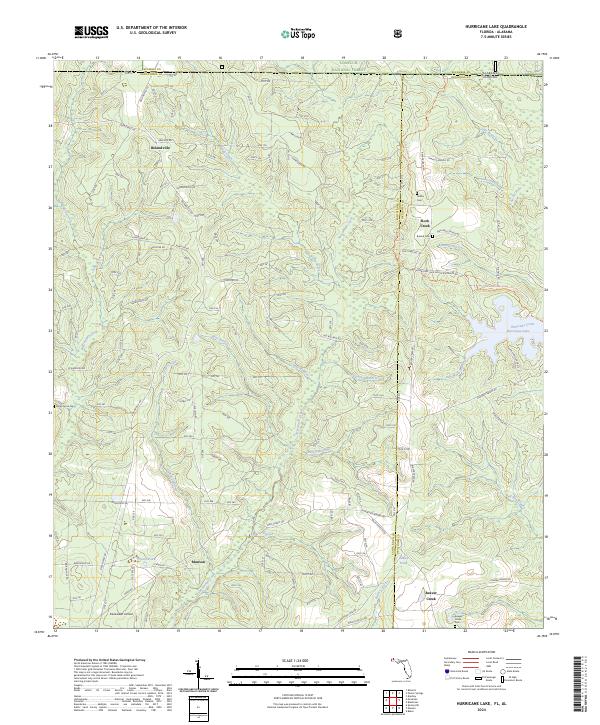
2024 Map of Hurricane Lake
USGS Topo · Published 2024About this map
Munson and Belandville anchor this southern forest landscape where the Alabama Florida state line meets the northern edge of the Blackwater River State Forest. The terrain is defined by an intricate network of waterways, including Big Juniper Creek and Sweetwater Creek, which carve through the timberlands. In the eastern portion of the map, Hurricane Lake serves as a significant recreational landmark, surrounded by the Florida National Scenic Trl. This modern survey reflects the enduring rural character of the region, where historical family names are preserved on cemetery markers at Valley Grove Cem, Hobbs Cem, and Bullard Cem. The presence of Blackwater Airfield near the southern boundary and the sprawling Conecuh National Forest to the north illustrates the mix of state and federal land management that has shaped the local geography for decades.
Find a feature on this map
67 named features on this map. Tap any name to fly to it.
Don’t see what you’re looking for? This feature index may not catch every label — zoom into the map to look around manually.
Map Details
Editions of this 2024 Hurricane Lake Map
This is the sole edition of this map. No revisions or reprints were ever made.
Other maps of this area

1948 · Munson
USGS Topo · 1:62,500

1949 · Crestview
USGS Topo · 1:62,500

1950 · Munson
USGS Topo · 1:62,500

1951 · Crestview
USGS Topo · 1:62,500

1953 · Andalusia
USGS Topo · 1:250,000

1957 · Andalusia
USGS Topo · 1:250,000

1957 · Pensacola
USGS Topo · 1:250,000

1959 · Pensacola
USGS Topo · 1:250,000

1960 · Pensacola
USGS Topo · 1:250,000

1971 · Bradley
USGS Topo · 1:24,000