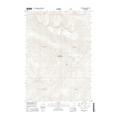
2015 Map of Hurricane Mesa
USGS Topo · Published 2015About this map
Hurricane Mesa and the surrounding high-altitude terrain of the Absaroka Range dominate this 2015 study of northwestern Wyoming. Situated within the Shoshone National Forest, the landscape is defined by its complex drainage systems, including the N Fork Crandall Cr and Papoose Cr. To the southwest, Indian Peak rises as a prominent landmark, while secluded water sources like Brown Bear Spring are tucked away in the steep topography. This map reveals a wilderness area shaped by geological forces, where the absence of established settlements highlights the preservation of the back-country. Names like One Hunt Cr and Hoodoo Cr reflect a landscape that remains tied to its early hunting and exploration history, providing a detailed record of the physical geography before 21st-century environmental shifts.
Find a feature on this map
19 named features on this map. Tap any name to fly to it.
Don’t see what you’re looking for? This feature index may not catch every label — zoom into the map to look around manually.
Map Details
Editions of this 2015 Hurricane Mesa Map
This is the sole edition of this map. No revisions or reprints were ever made.
Other maps of this area

1896 · Crandall Creek
USGS Topo · 1:125,000

1899 · Crandall
USGS Topo · 1:125,000

1955 · Cody
USGS Topo · 1:250,000

1956 · Sunlight Peak
USGS Topo · 1:62,500

1956 · Beartooth Butte
USGS Topo · 1:62,500

1956 · Pilot Peak
USGS Topo · 1:62,500

1956 · Dead Indian Peak
USGS Topo · 1:62,500

1958 · Cody
USGS Topo · 1:250,000

1962 · Cody
USGS Topo · 1:250,000

1980 · Cody
USGS Topo · 1:100,000