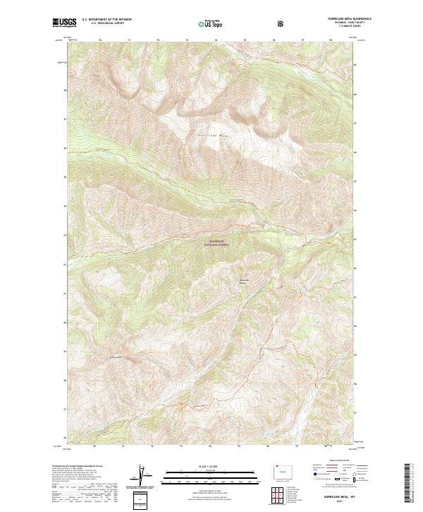
2021 Map of Hurricane Mesa
USGS Topo · Published 2021About this map
Hurricane Mesa stands as a prominent geographic feature in this high-elevation landscape within the Shoshone National Forest. Part of the wider Absaroka Range, the area is defined by sharp topographic relief and a network of drainages and seasonal water sources like Brown Bear Spring. The map documents a sophisticated system of primitive access routes, including the Closed Creek Trl and Papoose Ridge Trl, which navigate the steep terrain between Indian Peak and the various forks of the Crandall Cr. These trails signify the enduring importance of traditional backcountry travel ways in one of the nation's earliest protected wilderness regions. The map further details the hydrology of the area, tracing the courses of N Fork Crandall Cr and Hoodoo Cr through the deep canyons.
Find a feature on this map
24 named features on this map. Tap any name to fly to it.
Don’t see what you’re looking for? This feature index may not catch every label — zoom into the map to look around manually.
Map Details
Editions of this 2021 Hurricane Mesa Map
This is the sole edition of this map. No revisions or reprints were ever made.
Other maps of this area

1896 · Crandall Creek
USGS Topo · 1:125,000

1899 · Crandall
USGS Topo · 1:125,000

1955 · Cody
USGS Topo · 1:250,000

1956 · Sunlight Peak
USGS Topo · 1:62,500

1956 · Beartooth Butte
USGS Topo · 1:62,500

1956 · Pilot Peak
USGS Topo · 1:62,500

1956 · Dead Indian Peak
USGS Topo · 1:62,500

1958 · Cody
USGS Topo · 1:250,000

1962 · Cody
USGS Topo · 1:250,000

1980 · Cody
USGS Topo · 1:100,000