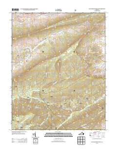
2013 Map of Hutchinson Rock
USGS Topo · Published 2013About this map
Hutchinson Rock stands as a prominent landmark in this section of Tazewell County, overlooking a landscape defined by parallel mountain ridges and deep drainage hollows. The settlement at Joe Neets and the aptly named Poor Valley sit among the high peaks of Garden Mountain and Beartown Ridge, where the terrain dictates the winding path of Va-602 and Roaring Fork Rd. This modern survey illustrates the persistent isolation of these mountain communities, where local life follows the gaps and valleys created by the S Fork Clinch River and Little Cr.
Find a feature on this map
59 named features on this map. Tap any name to fly to it.
Don’t see what you’re looking for? This feature index may not catch every label — zoom into the map to look around manually.
Map Details
Editions of this 2013 Hutchinson Rock Map
This is the sole edition of this map. No revisions or reprints were ever made.
Other maps of this area

1887 · Pocahontas
USGS Topo · 1:125,000

1889 · Wytheville
USGS Topo · 1:125,000

1891 · Tazewell
USGS Topo · 1:125,000

1891 · Pocahontas
USGS Topo · 1:125,000

1891 · Abingdon
USGS Topo · 1:125,000

1892 · Wytheville
USGS Topo · 1:125,000

1894 · Pocahontas
USGS Topo · 1:125,000

1894 · Abingdon
USGS Topo · 1:125,000

1895 · Tazewell
USGS Topo · 1:125,000

1895 · Pocahontas
USGS Topo · 1:125,000