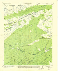
1935 Map of Hutchinson Rock
USGS Topo · Published 1935About this map
Hutchinson Rock stands as a prominent landmark on the high crest of Garden Mountain in this 1930s survey of the Tazewell and Bland county border. The landscape is defined by long parallel ridges including Rich Mountain and Clinch Mountain, which enclose unique depression valleys such as Burkes Garden Valley and Medley Valley. Human settlement follows the narrow corridors and water sources, represented by the Thompson Sch and the community of Maiden. Local industry and infrastructure are noted through multiple operations such as Burkes Garden No 2 and Burkes Garden No 4, while a Fire Tower watches over the heights of Chestnut Ridge. This era shows the rural character of the Appalachian highlands before modern development, anchored by local congregations at Marys Chapel and Mt Victory Ch.
Find a feature on this map
35 named features on this map. Tap any name to fly to it.
Don’t see what you’re looking for? This feature index may not catch every label — zoom into the map to look around manually.
Map Details
Editions of this 1935 Hutchinson Rock Map
This is the sole edition of this map. No revisions or reprints were ever made.
Other maps of this area

1887 · Pocahontas
USGS Topo · 1:125,000

1889 · Wytheville
USGS Topo · 1:125,000

1891 · Tazewell
USGS Topo · 1:125,000

1891 · Pocahontas
USGS Topo · 1:125,000

1891 · Abingdon
USGS Topo · 1:125,000

1892 · Wytheville
USGS Topo · 1:125,000

1894 · Pocahontas
USGS Topo · 1:125,000

1894 · Abingdon
USGS Topo · 1:125,000

1895 · Tazewell
USGS Topo · 1:125,000

1895 · Pocahontas
USGS Topo · 1:125,000