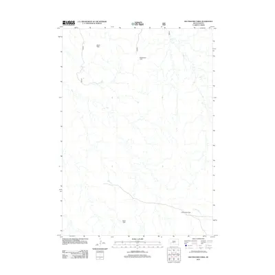
2012 Map of Hutmacher Table
USGS Topo · Published 2012About this map
Heutmacher Table and Zebell Table characterize the high-altitude topography of this corner of South Dakota, where flat-topped mesas rise above a network of seasonal drainages. The landscape is defined by its distinct landforms, including the broad expanse of Cactus Flats to the south and the strategic navigation point at Cottonwood Pass. The drainage patterns of Indian Cr and N Cottonwood Cr reveal how water moves through this semi-arid environment, carving into the terrain below the tables. This 2012 survey illustrates a sparsely settled region where the physical geography remains the primary feature, and the presence of Cottonwood Pass suggests a traditional route through the breaks and ridges of the Badlands area.
Find a feature on this map
7 named features on this map. Tap any name to fly to it.
Don’t see what you’re looking for? This feature index may not catch every label — zoom into the map to look around manually.
Map Details
Editions of this 2012 Hutmacher Table Map
This is the sole edition of this map. No revisions or reprints were ever made.
Other maps of this area

1950 · Sheep Mountain Table
USGS Topo · 1:24,000

1950 · Stirk Table
USGS Topo · 1:24,000

1950 · Cuny Table East
USGS Topo · 1:24,000

1951 · Heutmacher Table
USGS Topo · 1:24,000

1951 · Red Shirt NE
USGS Topo · 1:24,000

1951 · Cuny Table West
USGS Topo · 1:24,000

1953 · Folsom
USGS Topo · 1:24,000

1954 · Scenic
USGS Topo · 1:24,000

1954 · Scenic SW
USGS Topo · 1:24,000

1955 · Hot Springs
USGS Topo · 1:250,000