
1953 Map of Folsom
USGS Topo · Published 1955About this map
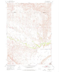
Spring Creek meanders through the heart of this mid-century western South Dakota landscape, carving a lush valley through the rugged breaks between Pennington and Custer counties. This 1953 field check captures the modest settlement of Folsom, a quiet hub in a vast ranching and dry-farming region. The topography transitions from the striking Railroad Buttes in the north to the expansive, high-altitude plateau of Phiney Flat in the southeast. A clear picture of rural education during the post-war era is preserved here, specifically through the location of the McMann Sch, which served the families working these isolated tracts. The map reveals the early development of the Missouri River Basin project through its detailed topographic surveying, illustrating how water and elevation dictated the placement of homesteads and winding dirt roads.
Find a feature on this map
6 named features on this map. Tap any name to fly to it.
Don’t see what you’re looking for? This feature index may not catch every label — zoom into the map to look around manually.
Map Details
Editions of this 1953 Folsom Map
2 editions found
Other maps of this area

1951 · Red Shirt
USGS Topo · 1:24,000

1951 · Heutmacher Table
USGS Topo · 1:24,000

1951 · Red Shirt NE
USGS Topo · 1:24,000

1953 · Caputa
USGS Topo · 1:24,000

1953 · Caputa NE
USGS Topo · 1:24,000

1953 · Caputa SW
USGS Topo · 1:24,000

1954 · Creston
USGS Topo · 1:24,000

1954 · Scenic SW
USGS Topo · 1:24,000

1955 · Hot Springs
USGS Topo · 1:250,000

1981 · Wall
USGS Topo · 1:100,000