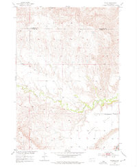
1953 Map of Folsom
USGS Topo · Published 1976About this map
Folsom serves as the primary landmark on this South Dakota survey, situated along the county line where Pennington Co and Custer Co meet. The landscape is defined by the winding course of Spring Creek, which meanders eastward toward its confluence with the Cheyenne R in the southeast corner. This mid-century study reveals a sparsely populated ranching and agricultural region, where local education centered on the McMann Sch near the eastern edge of the quadrangle. High ground is marked by the distinctive Railroad Buttes to the north, while the southern portion of the map is dominated by the broad expanse of Phiney Flat. This topographic record, based on 1948 aerial photography and 1953 field checks, provides a clear view of the rural road network and section lines as they existed during the development of the Missouri River Basin project.
Find a feature on this map
7 named features on this map. Tap any name to fly to it.
Don’t see what you’re looking for? This feature index may not catch every label — zoom into the map to look around manually.
Map Details
Editions of this 1953 Folsom Map
2 editions found
Other maps of this area

1951 · Red Shirt
USGS Topo · 1:24,000

1951 · Heutmacher Table
USGS Topo · 1:24,000

1951 · Red Shirt NE
USGS Topo · 1:24,000

1953 · Caputa
USGS Topo · 1:24,000

1953 · Folsom
USGS Topo · 1:24,000

1953 · Caputa NE
USGS Topo · 1:24,000

1953 · Caputa SW
USGS Topo · 1:24,000

1954 · Creston
USGS Topo · 1:24,000

1954 · Scenic SW
USGS Topo · 1:24,000

1955 · Hot Springs
USGS Topo · 1:250,000