
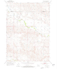
1953 Map of Caputa SW
USGS Topo · Published 1973About this map
The Pennington Co Custer Co boundary line divides this landscape of the Black Hills foothills, where the terrain is defined by an intricate network of seasonal drainage patterns and creek systems. Spring Creek meanders through the central portion of the quadrangle, while Battle Creek marks the southern reach, revealing the hydrologic character of the region before modern development. Notable local landmarks like the Lauzon Ranch and Flag Mountain provide fixed points for family history and land-use research in this mid-century period.
Find a feature on this map
12 named features on this map. Tap any name to fly to it.
Don’t see what you’re looking for? This feature index may not catch every label — zoom into the map to look around manually.
Map Details
Editions of this 1953 Caputa SW Map
2 editions found
Other maps of this area

1894 · Hermosa
USGS Topo · 1:125,000

1901 · Hermosa
USGS Topo · 1:125,000

1951 · Red Shirt
USGS Topo · 1:24,000

1951 · Red Shirt NE
USGS Topo · 1:24,000

1953 · Caputa
USGS Topo · 1:24,000

1953 · Hermosa SE
USGS Topo · 1:24,000

1953 · Folsom
USGS Topo · 1:24,000
1953 · Hermosa NE
USGS Topo · 1:24,000

1953 · Caputa NE
USGS Topo · 1:24,000

1955 · Hot Springs
USGS Topo · 1:250,000