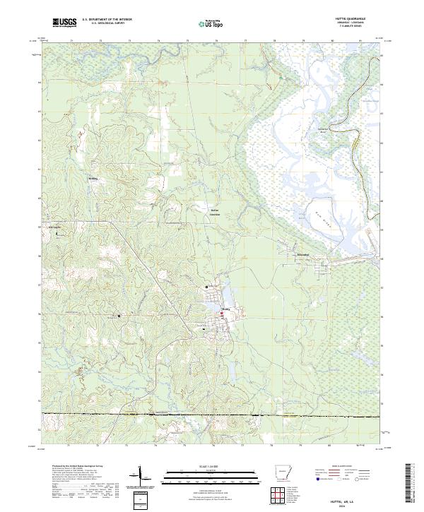
2024 Map of Huttig
USGS Topo · Published 2024About this map
Huttig and Felsenthal anchor this landscape along the Arkansas-Louisiana border, where the industrial legacy of the timber era meets the expansive wetlands of the Felsenthal National Wildlife Refuge. The map captures a complex network of waterways, including the Ouachita River, Horseshoe Slough, and the Twenty Acre Millpond, illustrating the hydrological importance of the region. Local history is deeply embedded in the terrain through family-named landmarks and rural settlements like Old Lapile, Bolding, and Dollar Junction. Genealogists will find several burial grounds noted, such as Old Lapile Cem, Simms Cem, and Huttig Cem, which serve as quiet markers of the community's ancestral roots. The presence of New Lock 6 Rd and Old Lock 6 Rd hints at the historical navigation and water management along the river, while the Upper Ouachita National Wildlife Refuge marks the transition into Louisiana's Union Parish.
Find a feature on this map
73 named features on this map. Tap any name to fly to it.
Don’t see what you’re looking for? This feature index may not catch every label — zoom into the map to look around manually.
Map Details
Editions of this 2024 Huttig Map
This is the sole edition of this map. No revisions or reprints were ever made.
Other maps of this area

1933 · Strong
USGS Topo · 1:62,500

1934 · Felsenthal
USGS Topo · 1:62,500

1935 · Haile
USGS Topo · 1:62,500

1937 · Strong
USGS Topo · 1:62,500

1937 · Felsenthal
USGS Topo · 1:62,500

1938 · Felsenthal
USGS Topo · 1:62,500

1939 · Felsenthal
USGS Topo · 1:62,500

1939 · Strong
USGS Topo · 1:62,500

1952 · Farmerville
USGS Topo · 1:62,500

1953 · El Dorado
USGS Topo · 1:250,000