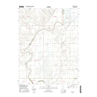
2016 Map of Hutton
USGS Topo · Published 2016About this map
The Wabash River carves a winding path along the Illinois-Indiana border, defining the landscape of this river-valley quadrangle. The settlement of Darwin sits near a prominent horseshoe curve at Aurora Bend, serving as a historical waypoint on the Illinois side. To the east, the communities of Hutton and Vigo anchor the Indiana portion of the map, surrounded by a network of drainage systems like Negro Ditch and Greenfield Bayou that manage the low-lying terrain. For genealogists and local historians, the sheet is heavily dotted with family-named burial sites, including Dean Cem, Shattuck Cem, and Lykens Cem. The transition from the river bottomlands to the interior is marked by features like Big Knoll and various wetlands such as Little Grassy Pond and Muskrat Pond, illustrating the ecological character of the borderlands during this 2016 survey.
Find a feature on this map
106 named features on this map. Tap any name to fly to it.
Don’t see what you’re looking for? This feature index may not catch every label — zoom into the map to look around manually.
Map Details
Editions of this 2016 Hutton Map
This is the sole edition of this map. No revisions or reprints were ever made.
Other maps of this area

1932 · Marshall
USGS Topo · 1:62,500

1937 · Marshall
USGS Topo · 1:62,500

1940 · Pimento
USGS Topo · 1:24,000

1941 · Terre Haute
USGS Topo · 1:24,000

1942 · Fairbanks
USGS Topo · 1:24,000

1942 · Shelburn
USGS Topo · 1:24,000

1942 · Hutton
USGS Topo · 1:24,000

1942 · Dennison
USGS Topo · 1:24,000

1948 · Terre Haute
USGS Topo · 1:24,000

1952 · Fairbanks
USGS Topo · 1:24,000