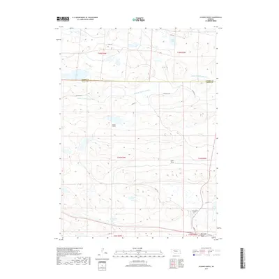
2017 Map of Hyannis North
USGS Topo · Published 2017About this map
Hyannis sits at the southern edge of this Sandhills landscape, where the town's grid meets the branching paths of the Burlington Northern Santa Fe rail corridor and local routes like S Railroad St and Alden Ave. The terrain is defined by a dense network of high-altitude wetlands and lakes, including Wolfenberger Lakes and Soda Lake, characteristic of this part of the Nebraska cattle country. The Cherry County and Grant County line cuts horizontally across the northern portion of the sheet, dividing a landscape largely shaped by the winding course of the Middle Br Middle Loup River. This 2017 survey details a ranching-heavy region where named valleys like Brown Valley and Lamb Valley provide low-lying points between the sand dunes, and the Grant County Airport serves as a vital transportation link for this sparsely populated portion of the Great Plains.
Find a feature on this map
27 named features on this map. Tap any name to fly to it.
Don’t see what you’re looking for? This feature index may not catch every label — zoom into the map to look around manually.
Map Details
Editions of this 2017 Hyannis North Map
This is the sole edition of this map. No revisions or reprints were ever made.
Other maps of this area

1948 · Ashby
USGS Topo · 1:62,500

1948 · George Lake
USGS Topo · 1:62,500

1948 · Whitman
USGS Topo · 1:62,500

1948 · Spring Valley
USGS Topo · 1:62,500

1949 · Ashby
USGS Topo · 1:62,500

1950 · Spring Valley
USGS Topo · 1:62,500

1950 · Whitman
USGS Topo · 1:62,500

1950 · George Lake
USGS Topo · 1:62,500

1954 · North Platte
USGS Topo · 1:250,000

1956 · North Platte
USGS Topo · 1:250,000