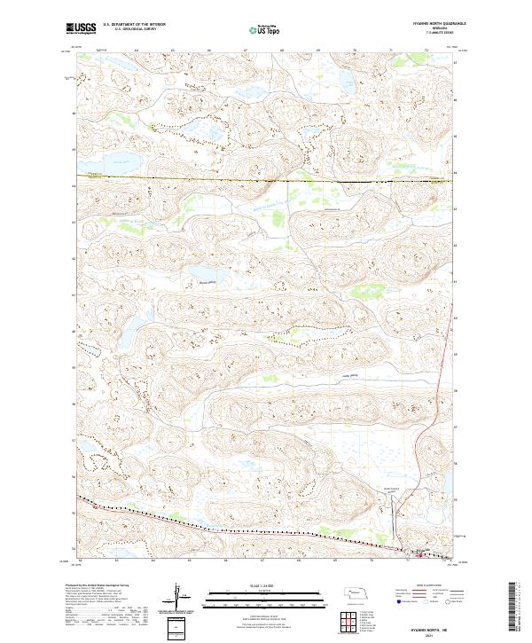
2021 Map of Hyannis North
USGS Topo · Published 2021About this map
The Middle Br Middle Loup River winds through the northern portion of this quadrangle, defining the terrain of the Nebraska Sandhills between Grant and Cherry counties. The settlement of Hyannis anchors the southeastern corner, serving as a vital ranching hub where local routes like S Railroad St and Alden Ave intersect near the railway corridor. This landscape is characterized by its internal drainage basins, evidenced by isolated water bodies such as Castle Lake, Soda Lake, and the Wolfenberger Lakes. Large depressions like Brown Valley and Lamb Valley illustrate the geological character of the region, while the presence of the Grant County Airport north of the town center marks the modern connectivity of this rural community. The township and range boundaries of t24n r39w and t24n r38w provide the cadastral framework for the many private ranches accessed via primitive routes like Ashby Rd and Sibbitt Rd.
Find a feature on this map
26 named features on this map. Tap any name to fly to it.
Don’t see what you’re looking for? This feature index may not catch every label — zoom into the map to look around manually.
Map Details
Editions of this 2021 Hyannis North Map
This is the sole edition of this map. No revisions or reprints were ever made.
Other maps of this area

1948 · Ashby
USGS Topo · 1:62,500

1948 · George Lake
USGS Topo · 1:62,500

1948 · Whitman
USGS Topo · 1:62,500

1948 · Spring Valley
USGS Topo · 1:62,500

1949 · Ashby
USGS Topo · 1:62,500

1950 · Spring Valley
USGS Topo · 1:62,500

1950 · Whitman
USGS Topo · 1:62,500

1950 · George Lake
USGS Topo · 1:62,500

1954 · North Platte
USGS Topo · 1:250,000

1956 · North Platte
USGS Topo · 1:250,000