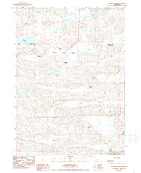
1989 Map of Hyannis North
USGS Topo · Published 1989About this map
The Nebraska Sandhills of Grant and Cherry Counties are defined by a network of ranching homesteads and alkaline basins in this late 20th-century survey. The village of Hyannis serves as the regional anchor in the southeast corner, situated along the Burlington Northern railroad corridor. The surrounding landscape is a complex of valleys and ridges, featuring prominent family operations such as the J Brenneman, B Brenneman, and G Brenneman ranches.
Find a feature on this map
21 named features on this map. Tap any name to fly to it.
Don’t see what you’re looking for? This feature index may not catch every label — zoom into the map to look around manually.
Map Details
Editions of this 1989 Hyannis North Map
This is the sole edition of this map. No revisions or reprints were ever made.
Other maps of this area

1948 · Ashby
USGS Topo · 1:62,500

1948 · George Lake
USGS Topo · 1:62,500

1948 · Whitman
USGS Topo · 1:62,500

1948 · Spring Valley
USGS Topo · 1:62,500

1949 · Ashby
USGS Topo · 1:62,500

1950 · Spring Valley
USGS Topo · 1:62,500

1950 · Whitman
USGS Topo · 1:62,500

1950 · George Lake
USGS Topo · 1:62,500

1954 · North Platte
USGS Topo · 1:250,000

1956 · North Platte
USGS Topo · 1:250,000