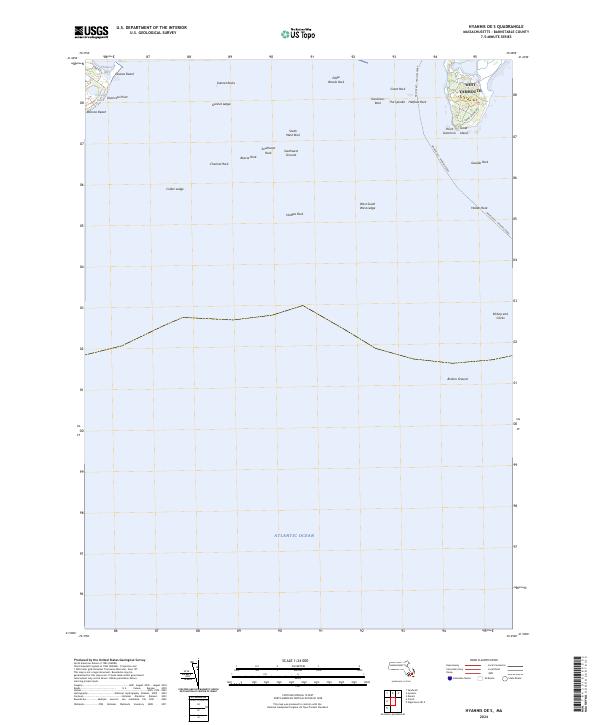
2024 Map of Hyannis OE S
USGS Topo · Published 2024About this map
West Yarmouth and the waters of the Atlantic Ocean define this coastal survey, where the terrestrial landscape of Cape Cod gives way to a complex seafloor of ledges and named rocks. The map highlights the significant maritime approach to the mainland, tracing the path of the Nantucket - Hyannis Ferry as it navigates past hazardous features such as Bishop and Clerks and Broken Ground.
Find a feature on this map
31 named features on this map. Tap any name to fly to it.
Don’t see what you’re looking for? This feature index may not catch every label — zoom into the map to look around manually.
Map Details
Editions of this 2024 Hyannis OE S Map
This is the sole edition of this map. No revisions or reprints were ever made.
Other maps of this area

1887 · Muskeget
USGS Topo · 1:62,500

1887 · Yarmouth
USGS Topo · 1:62,500

1888 · Barnstable
USGS Topo · 1:62,500

1889 · Muskeget
USGS Topo · 1:62,500

1889 · Yarmouth
USGS Topo · 1:62,500

1893 · Muskeget
USGS Topo · 1:62,500

1893 · Yarmouth
USGS Topo · 1:62,500

1893 · Barnstable
USGS Topo · 1:62,500

1899 · Muskeget
USGS Topo · 1:62,500
1941 · Cotuit
USGS Topo · 1:31,680