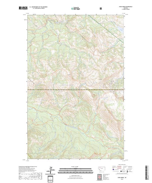
2024 Map of Hyde Creek
USGS Topo · Published 2024About this map
The Sawtooth Range anchors this high-elevation landscape along the border of Glacier and Pondera Counties, where the Lewis & Clark National Forest meets the Flathead National Forest. This modern survey reveals a complex network of backcountry routes, most notably the Continental Divide National Scenic Trl, which traverses the southern portion of the quadrangle. The terrain is defined by dramatic ridgelines such as Two Medicine Ridge and peaks including Mt Baldy.
Find a feature on this map
44 named features on this map. Tap any name to fly to it.
Don’t see what you’re looking for? This feature index may not catch every label — zoom into the map to look around manually.
Map Details
Editions of this 2024 Hyde Creek Map
This is the sole edition of this map. No revisions or reprints were ever made.
Other maps of this area

1913 · Marias Pass
USGS Topo · 1:125,000

1958 · Red Plume Mountain
USGS Topo · 1:24,000

1958 · Crescent Cliff
USGS Topo · 1:24,000

1960 · Cut Bank
USGS Topo · 1:250,000

1963 · Cut Bank
USGS Topo · 1:250,000

1964 · Cut Bank
USGS Topo · 1:250,000

1968 · Half Dome Crag
USGS Topo · 1:24,000
1968 · Morningstar Mountain
USGS Topo · 1:24,000
1968 · East Glacier Park
USGS Topo · 1:24,000
1968 · Squaw Mountain
USGS Topo · 1:24,000