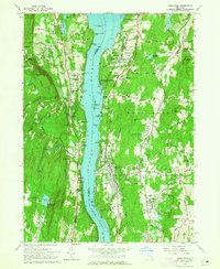
1963 Map of Hyde Park
USGS Topo · Published 1965About this map
The Hudson River defines the landscape of this 1963 survey, serving as the central artery between the shores of Esopus and Hyde Park. Along the eastern bank, the proximity of the New York Central railroad tracks to the water's edge underscores the vital transportation corridor of the mid-20th century. This era is marked by a significant concentration of religious and educational institutions, including the Mt St Alphonsus Seminary, Marist Brothers Seminary, and Eymard Seminary, reflecting a localized cluster of academic and spiritual life. Preservation and history are anchored by the F D Roosevelt Home National Historic Site and the Vanderbilt Mansion National Historic Site, while the Esopus Meadows Lighthouse stands as a navigational sentinel in the channel. The map also captures several smaller settlements such as Staatsburg and West Park, alongside local industries represented by the Gravel Pit and Sand and Gravel Pit near the Fall Kill.
Find a feature on this map
95 named features on this map. Tap any name to fly to it.
Don’t see what you’re looking for? This feature index may not catch every label — zoom into the map to look around manually.
Map Details
Editions of this 1963 Hyde Park Map
2 editions found
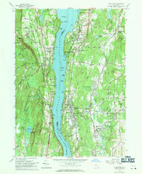
Other maps of this area

1893 · Poughkeepsie
USGS Topo · 1:62,500

1894 · Poughkeepsie
USGS Topo · 1:62,500

1898 · Rhinebeck
USGS Topo · 1:62,500

1901 · Rosendale
USGS Topo · 1:62,500

1903 · Poughkeepsie
USGS Topo · 1:62,500

1903 · Newburg
USGS Topo · 1:62,500

1903 · Rosendale
USGS Topo · 1:62,500

1934 · Rhinebeck
USGS Topo · 1:48,000

1936 · Poughkeepsie
USGS Topo · 1:48,000

1939 · Rhinebeck
USGS Topo · 1:62,500