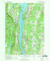
1963 Map of Hyde Park
USGS Topo · Published 1971About this map
The Hudson River bisects this mid-century landscape, defining the boundaries between Ulster and Dutchess counties. On the eastern shore, the estates of the Hudson Valley elite are well-established, anchored by the Vanderbilt Mansion National Historic Site and the F D Roosevelt Home National Historic Site, including the specific location of the tomb. The western bank in Ulster Park and Esopus reveals a dense concentration of religious and educational institutions, such as the Mother of Perpetual Help Monastery and Mt St Alphonsus Seminary. The transportation corridor is dominated by the New York Central railroad and New York 9W, supporting riverfront communities like Staatsburg and Hyde Park. This era shows a transition from private riverside estates toward public preservation, evidenced by Mills State Memorial Park and Norrie State Park.
Find a feature on this map
78 named features on this map. Tap any name to fly to it.
Don’t see what you’re looking for? This feature index may not catch every label — zoom into the map to look around manually.
Map Details
Editions of this 1963 Hyde Park Map
2 editions found
Other maps of this area

1893 · Poughkeepsie
USGS Topo · 1:62,500

1894 · Poughkeepsie
USGS Topo · 1:62,500

1898 · Rhinebeck
USGS Topo · 1:62,500

1901 · Rosendale
USGS Topo · 1:62,500

1903 · Poughkeepsie
USGS Topo · 1:62,500

1903 · Newburg
USGS Topo · 1:62,500

1903 · Rosendale
USGS Topo · 1:62,500

1934 · Rhinebeck
USGS Topo · 1:48,000

1936 · Poughkeepsie
USGS Topo · 1:48,000

1939 · Rhinebeck
USGS Topo · 1:62,500