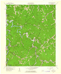
1961 Map of Hyden East
USGS Topo · Published 1963About this map
Buckhorn Reservoir and the Middle Fork Kentucky River dominate this eastern Kentucky landscape, reflecting a region defined by its deep winding valleys and narrow ridges. Centered around the community of Wooton, the map illustrates a network of small settlements tucked into the hollows of Leslie and Perry Counties. The infrastructure of the early 1960s is evident in the numerous small educational buildings, such as Avawam Sch, Upper Macintosh Sch, and Lower Polla Creek Sch, which served as local anchors for these rural creek-side neighborhoods. Evidence of the local coal economy appears through Mines and a Tipple located near the headwaters of the branches. Along the southern edge, the settlement of Wendover sits near the river, while landmarks like the Jacks Point Lookout Tower provided a vital vantage point over the timbered slopes of the Cumberland Plateau.
Find a feature on this map
80 named features on this map. Tap any name to fly to it.
Don’t see what you’re looking for? This feature index may not catch every label — zoom into the map to look around manually.
Map Details
Editions of this 1961 Hyden East Map
This is the sole edition of this map. No revisions or reprints were ever made.
Other maps of this area

1891 · Hazard
USGS Topo · 1:125,000

1913 · Buckhorn
USGS Topo · 1:62,500

1914 · Troublesome
USGS Topo · 1:62,500

1916 · Cornettsville
USGS Topo · 1:62,500

1916 · Hyden
USGS Topo · 1:48,000

1919 · Hyden
USGS Topo · 1:62,500

1953 · Buckhorn
USGS Topo · 1:24,000

1953 · Hyden West
USGS Topo · 1:24,000

1954 · Krypton
USGS Topo · 1:24,000
1954 · Hyden East
USGS Topo · 1:24,000