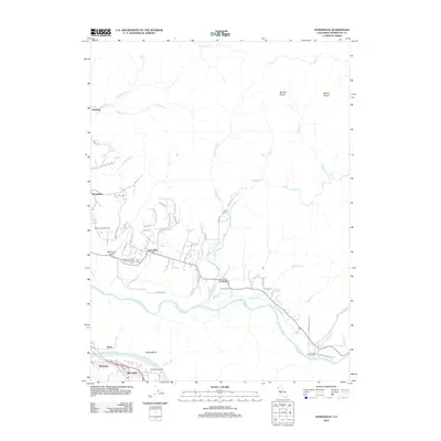
2012 Map of Hydesville
USGS Topo · Published 2012About this map
Hydesville and the surrounding river valleys in Humboldt County are defined by the convergence of the Van Duzen River and the Eel River. This landscape reflects a deep history of timber and transport, where the Yager Creek and Cuddeback Creek drainages meet the main river arteries. The map documents several important local burial grounds, including the Independent Order of Odd Fellows Cemetery and the Masons and IOOF Cemetery, which serve as vital touchstones for genealogists tracing early North Coast families. To the south, the dramatic Scotia Bluffs overlook Rio Dell and Belleview, while the northern hills are home to upland features like Blanton Prairie and Myrick Prairie. The intricate network of rural roads, such as Rohnerville Road and Barber Creek Road, connects established settlements like Carlotta and Rohnerville with more remote locales like Yager Camp.
Find a feature on this map
70 named features on this map. Tap any name to fly to it.
Don’t see what you’re looking for? This feature index may not catch every label — zoom into the map to look around manually.
Map Details
Editions of this 2012 Hydesville Map
This is the sole edition of this map. No revisions or reprints were ever made.
Other maps of this area

1919 · Glynn
USGS Topo · 1:62,500

1921 · Dyerville
USGS Topo · 1:62,500

1922 · Kneeland
USGS Topo · 1:62,500

1944 · Fortuna
USGS Topo · 1:62,500

1949 · Eureka
USGS Topo · 1:250,000

1949 · Weott
USGS Topo · 1:62,500

1950 · Iaqua Buttes
USGS Topo · 1:62,500

1950 · Scotia
USGS Topo · 1:62,500

1951 · Scotia
USGS Topo · 1:62,500

1951 · Weott
USGS Topo · 1:62,500