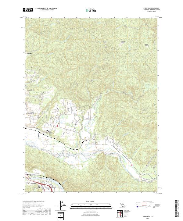
2021 Map of Hydesville
USGS Topo · Published 2021About this map
The Van Duzen River and Eel River converge at the southern edge of this Humboldt County landscape, defining the corridor for the Northwestern Pacific RR and Highway 101. The settlement of Hydesville sits on a plateau above the river valley, serving as a focal point for local history with the Hydesville Sch and several fraternal cemeteries including the Masons and Independent Order of Odd Fellows Cem. To the east, Carlotta marks the junction where the landscape transitions from river bottoms to the timbered uplands of Blanton Prairie and Myrick Prairie. The terrain is deeply incised by drainages like Wolverton Gulch and Cuddeback Cr, while the dramatic Scotia Bluffs rise sharply from the Eel River banks. This map documents a region where river-valley agriculture and transport infrastructure meet the managed forest lands of the Pacific Northwest, captured in the early 21st century.
Find a feature on this map
102 named features on this map. Tap any name to fly to it.
Don’t see what you’re looking for? This feature index may not catch every label — zoom into the map to look around manually.
Map Details
Editions of this 2021 Hydesville Map
This is the sole edition of this map. No revisions or reprints were ever made.
Other maps of this area

1919 · Glynn
USGS Topo · 1:62,500

1921 · Dyerville
USGS Topo · 1:62,500

1922 · Kneeland
USGS Topo · 1:62,500

1944 · Fortuna
USGS Topo · 1:62,500

1949 · Eureka
USGS Topo · 1:250,000

1949 · Weott
USGS Topo · 1:62,500

1950 · Iaqua Buttes
USGS Topo · 1:62,500

1950 · Scotia
USGS Topo · 1:62,500

1951 · Scotia
USGS Topo · 1:62,500

1951 · Weott
USGS Topo · 1:62,500