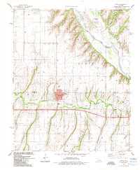
1985 Map of Hydro
USGS Topo · Published 1985About this map
Hydro serves as the focal point of this mid-1980s survey, situated along the Farmrail line just south of the Canadian River. The town's grid is clearly defined, featuring the local Townhall and Po, while the Hydro Cem sits to the north. This area reflects a landscape where infrastructure and agriculture are deeply integrated, evidenced by the numerous Gas Wells and Drill Holes scattered across the surrounding terrain of Hydro and Mound Valley.
Find a feature on this map
26 named features on this map. Tap any name to fly to it.
Don’t see what you’re looking for? This feature index may not catch every label — zoom into the map to look around manually.
Map Details
Editions of this 1985 Hydro Map
This is the sole edition of this map. No revisions or reprints were ever made.
Other maps of this area

1942 · Geary
USGS Topo · 1:62,500

1951 · Binger
USGS Topo · 1:62,500

1955 · Clinton
USGS Topo · 1:250,000

1957 · Clinton
USGS Topo · 1:250,000

1961 · Eakly
USGS Topo · 1:62,500

1964 · Weatherford
USGS Topo · 1:62,500

1979 · Greenfield
USGS Topo · 1:24,000
1979 · Rock Mary
USGS Topo · 1:24,000
1979 · Bridgeport
USGS Topo · 1:24,000
1984 · Eakly NE
USGS Topo · 1:24,000