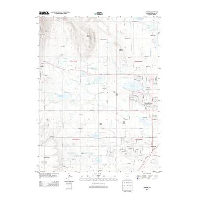
2013 Map of Hygiene
USGS Topo · Published 2013About this map
The community of Hygiene sits at the center of an intricate network of irrigation ditches and reservoirs, reflecting the agricultural heritage of the St. Vrain Valley. This landscape is defined by its water management, where the Saint Vrain Creek feeds a complex system including the Oligarchy Ditch, Rough and Ready Ditch, and Supply Ditch. These waterways support numerous reservoirs such as McIntosh Lake, McCall Lake, and Clover Basin Reservoir, which dot the plains between the prominent elevations of Rabbit Mountain and Table Mountain.
Find a feature on this map
111 named features on this map. Tap any name to fly to it.
Don’t see what you’re looking for? This feature index may not catch every label — zoom into the map to look around manually.
Map Details
Editions of this 2013 Hygiene Map
This is the sole edition of this map. No revisions or reprints were ever made.
Other maps of this area

1902 · Boulder
USGS Topo · 1:62,500

1904 · Niwot
USGS Topo · 1:62,500

1904 · Boulder
USGS Topo · 1:62,500

1905 · Mount Olympus
USGS Topo · 1:62,500

1906 · Loveland
USGS Topo · 1:62,500

1907 · Mount Olympus
USGS Topo · 1:62,500

1908 · Loveland
USGS Topo · 1:62,500

1950 · Hygiene
USGS Topo · 1:24,000
1950 · Erie
USGS Topo · 1:24,000

1950 · Niwot
USGS Topo · 1:24,000