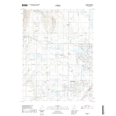
2019 Map of Hygiene
USGS Topo · Published 2019About this map
McIntosh Lake and the northwestern edge of Longmont dominate this landscape, where the high plains meet the foothills of the Front Range. The map reveals an intricate network of irrigation infrastructure essential to the region's agricultural history, including the Oligarchy Ditch, Palmerton Ditch, and Saint Vrain Supply Canal. These waterways snake between prominent geological features like Rabbit Mtn and Table Top Mtn, illustrating how the natural topography dictated the path of early water rights and settlement.
Find a feature on this map
169 named features on this map. Tap any name to fly to it.
Don’t see what you’re looking for? This feature index may not catch every label — zoom into the map to look around manually.
Map Details
Editions of this 2019 Hygiene Map
This is the sole edition of this map. No revisions or reprints were ever made.
Other maps of this area

1902 · Boulder
USGS Topo · 1:62,500

1904 · Niwot
USGS Topo · 1:62,500

1904 · Boulder
USGS Topo · 1:62,500

1905 · Mount Olympus
USGS Topo · 1:62,500

1906 · Loveland
USGS Topo · 1:62,500

1907 · Mount Olympus
USGS Topo · 1:62,500

1908 · Loveland
USGS Topo · 1:62,500

1950 · Hygiene
USGS Topo · 1:24,000
1950 · Erie
USGS Topo · 1:24,000

1950 · Niwot
USGS Topo · 1:24,000